Frequently Asked Questions


Find answers to the a list of common questions other users have asked. You can filter the results to a particular category or properties and services using the Filter by Category option below, and further refine your search useing the FAQ Search box.


Data


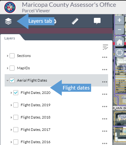
Aerial photos are typically flown by the chosen vendor between mid-September and early December depending on that year's coverage extents and weather. Specific flight date information for our maps can be found on the layers tab under Aerial Flight Dates. Please note: the actual flight dates are the calendar year before the photography is made available via the maps; for example, the 2019 aerials were taken in late 2018.
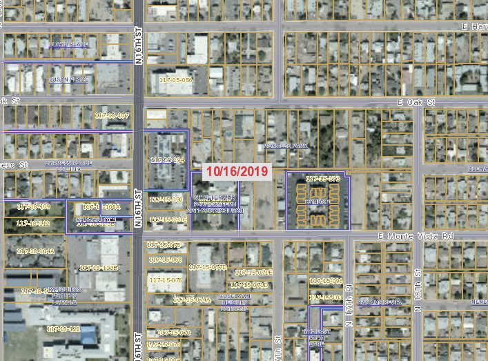
Exact flight date layer on 2019 Aerials.
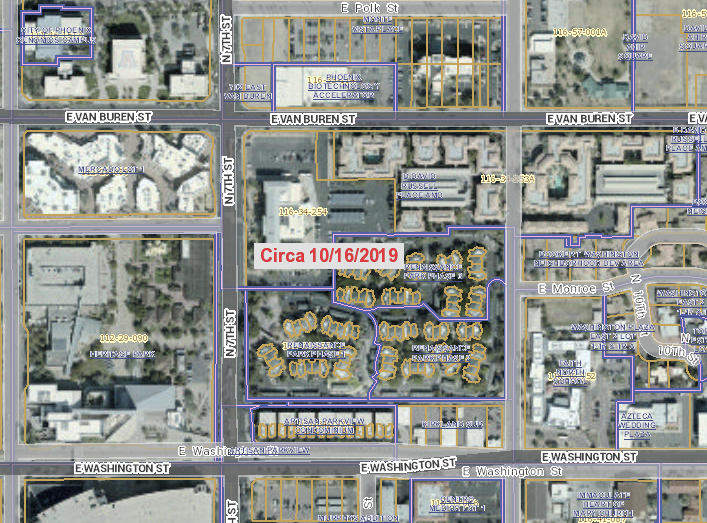

Approximate flight date later on 2019 Aerials.

If standard searching doesn’t meet your data needs, please visit our Reports and Data Sales pages for information on acquiring Assessor data in bulk.

Regular data users may want to ask their organization's Information Technology staff to arrange access to our Application Programming Interface (API) for GETs from the Assessor's public-facing database to use in other applications.

Light Detection and Ranging (LiDAR) data is not universally available for all areas of Maricopa County, and currently most of the County-led demand for LiDAR data stems from Flood Control or other very specific applications and not for appraisal. Any County LiDAR datasets that may be available to the general public are available from the Geographic Information Officer .

Our Maps site is useful for creating a mailing list of parcel owners within a defined distance (radius) from a point of interest. First, create a buffer around the point or parcel of interest. Then, in the results dialog, select the three dots in the upper right and the Export to CSV File option to retrieve a delimited file for your mailing list.

All Parcel Details pages include links to available maps, though not all parcels exist within areas that have published static maps. Map types available on Parcel Details pages most often include quarter-quarter-section views of parcel geometry.

For custom maps, use our Maps site to either print a map view to a PDF file, or you may screenshot an area of interest for inclusion in other documents.